Comprehensive Wildfire Mitigation Capabilities
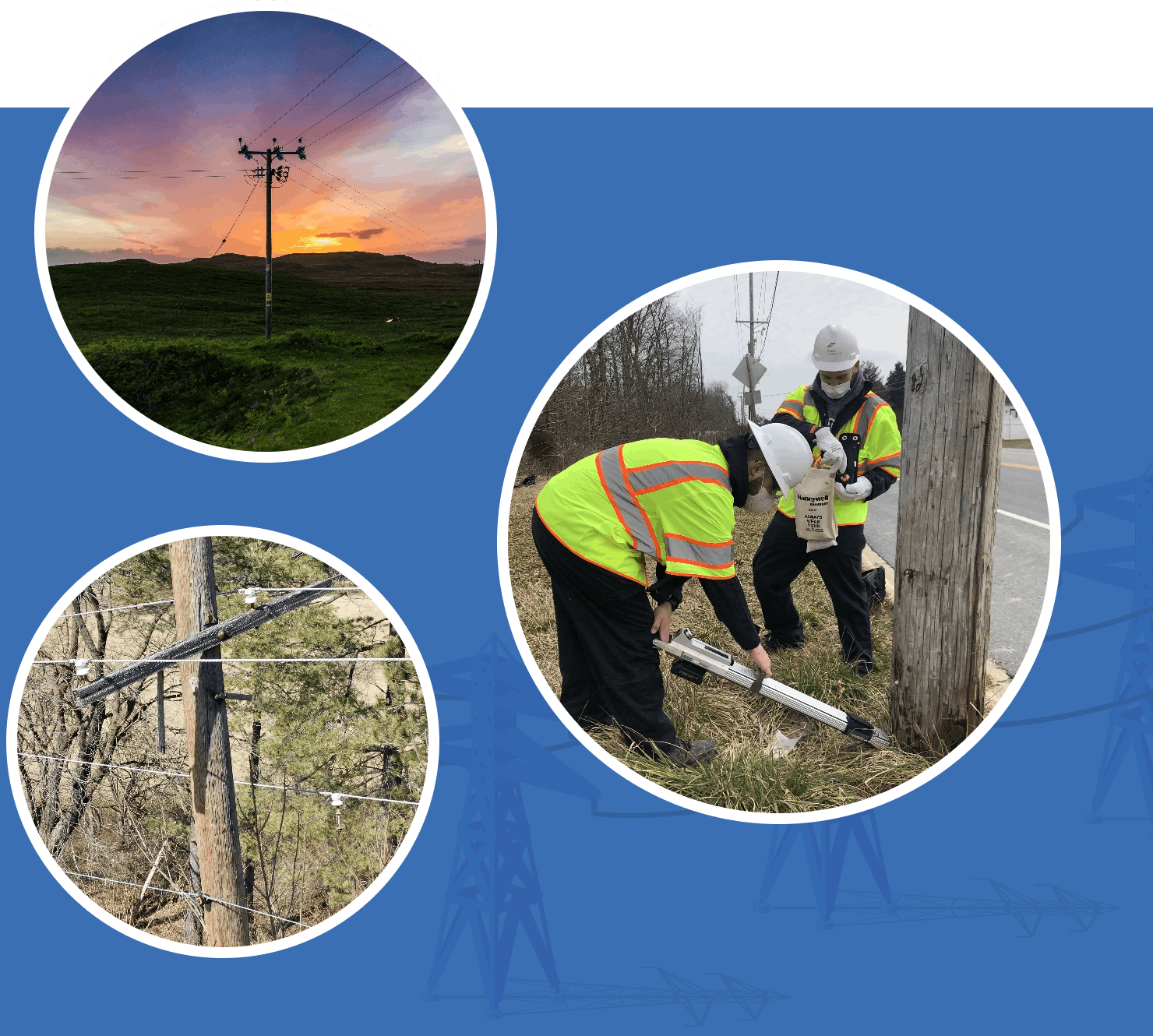
In the face of increasing wildfire threats, Clearsight offers a suite of innovative solutions to safeguard your energy infrastructure. With our advanced drone technology and experienced team, we go beyond traditional methods to provide unparalleled insights and actionable recommendations. Our digital inspections uncover an average of 50% more issues than ground-based inspections.
Wide-Ranging Solutions
Our comprehensive wildfire prevention services redefine risk management.
Rapid Wildfire Response Tech
Swift and accurate assessments of vegetation and infrastructure.
Actionable Expert Insights
Actionable insights for swift, impactful decisions that aid in preventing wildfires.
Secure Customer Portal
Essential information for effectively managing your infrastructure to prevent wildfires.
TRANSMISSION & DISTRIBUTION
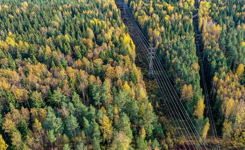
Visual Vegetation Management
Our advanced wildfire prevention system incorporates cutting-edge technology to address the critical issue of mitigating wildfires. Our comprehensive solution utilizes state-of-the-art drones for safer, high-resolution imagery, offering customizable aerial inspections that identify potential wildfire risks.
- Reduce safety hazards
- Improve decision making
- Unmatched aerial insights
TRANSMISSION & DISTRIBUTION
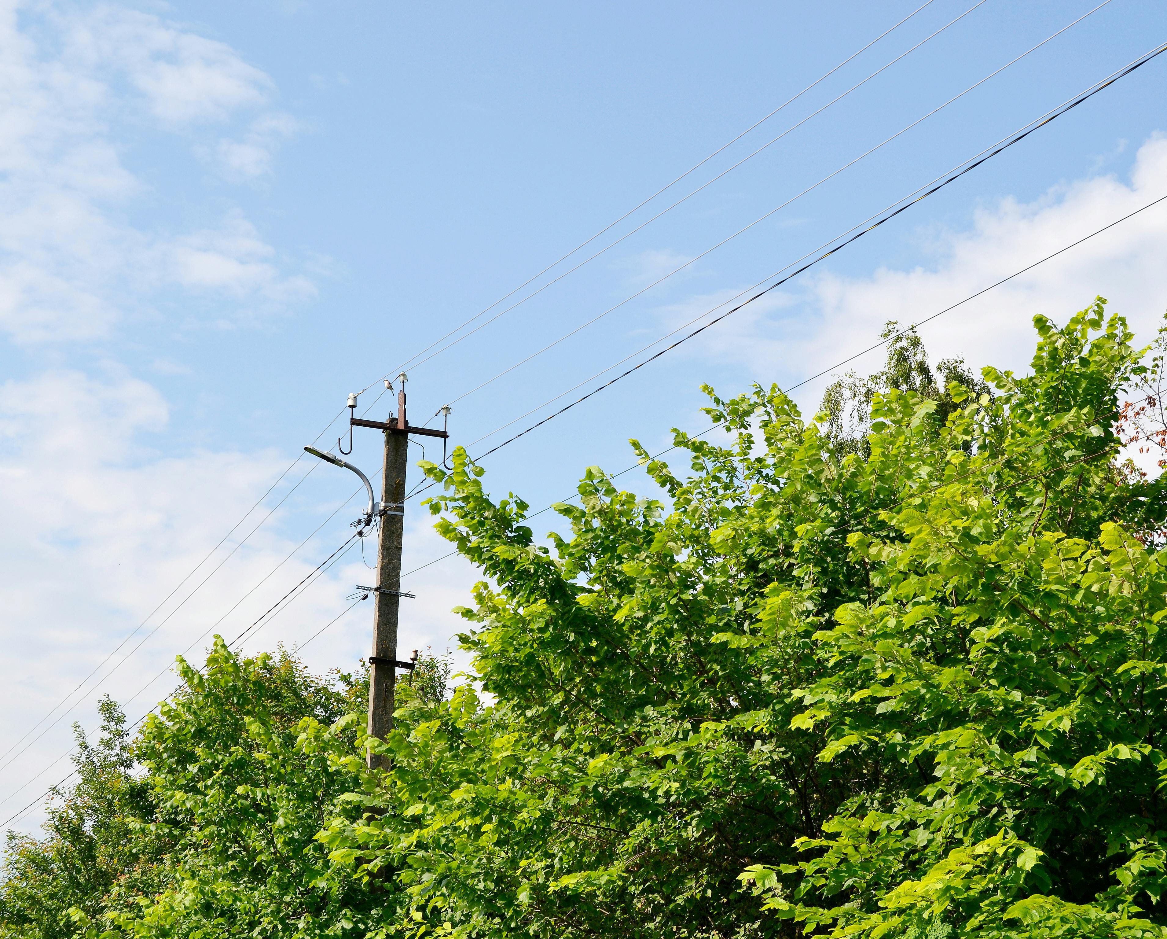
LiDAR Clearance Distance Surveys
Our robust solution offers precise engineering-grade measurements, enabling highly customizable analytics to identify potential fire-prone areas. With a focus on historical record-keeping, our system contributes to a comprehensive understanding of wildfire patterns and risks, all while minimizing safety hazards.
- Personalized solutions tailored to your needs
- Compliance with NERC standard FAC-003-4
- Collect in days what typically takes months
TRANSMISSION & DISTRIBUTION
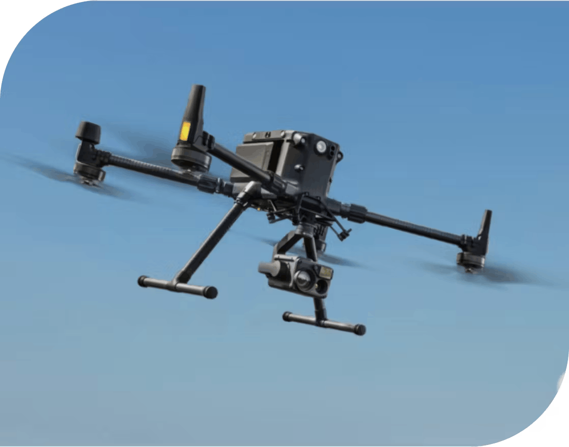
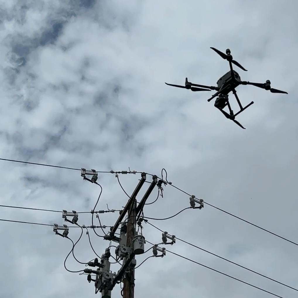
Aerial Drones
Our drone-based solution enables extensive inspections of potential fire risk zones, resulting in time efficiency, cost-effectiveness, and a reduced need for traditional ground-based assessments.
- 15km Max transmission
- 55-minute flight time
- 6 directional sensing and positioning
TRANSMISSION & DISTRIBUTION
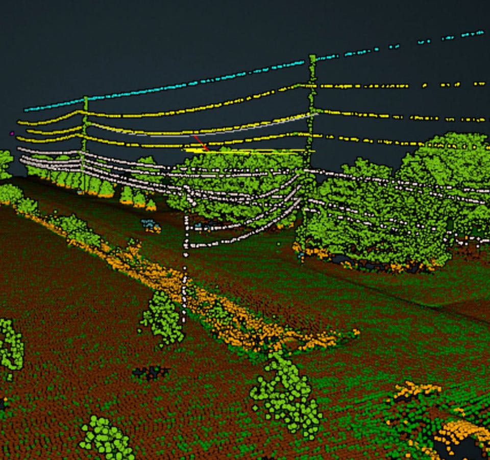
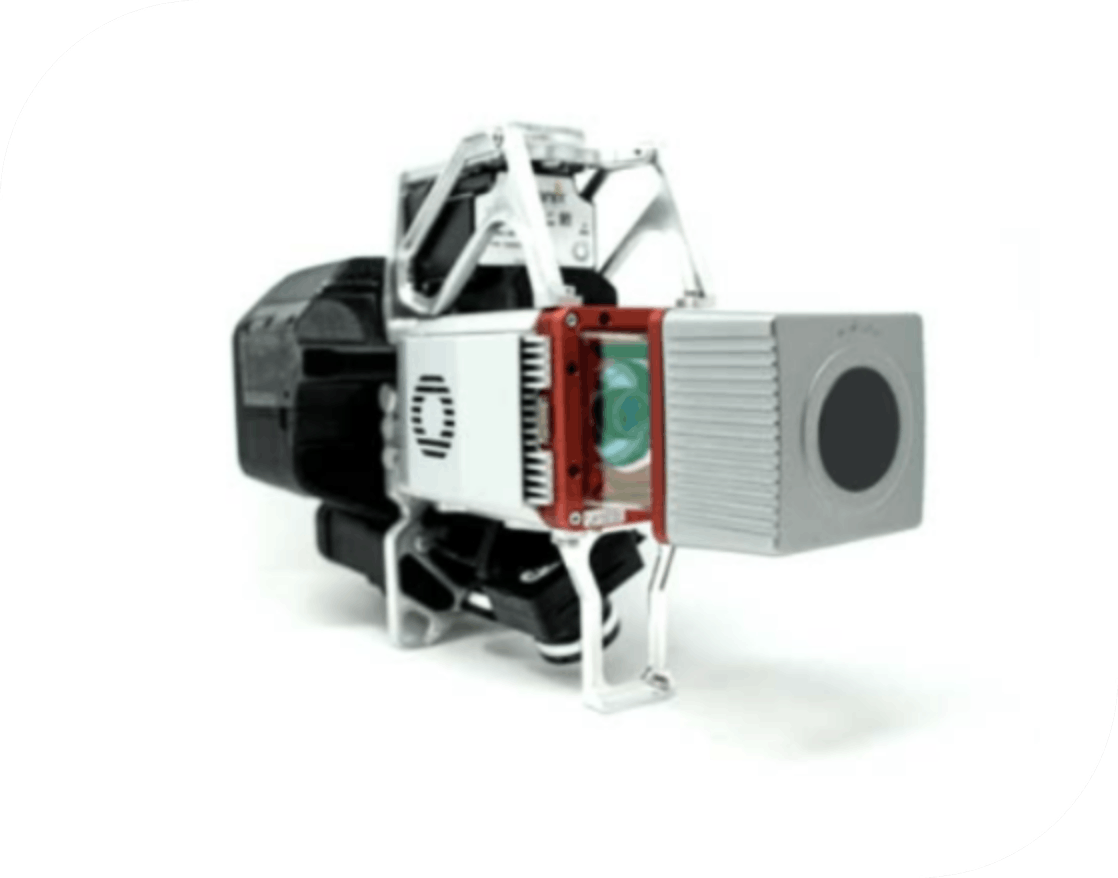
LiDAR Sensors
Our innovative 3D Imaging System plays a crucial role in wildfire prevention through meticulous infrastructure mapping. What sets it apart is its exceptional capacity to capture ground details in sparsely vegetated regions, positioning it as the ultimate cost-effective choice for creating utility-grade maps that aid in mitigating wildfire risks.
- 3D color mapping
- 120° field of view
- Vegetation penetration
TRANSMISSION & DISTRIBUTION
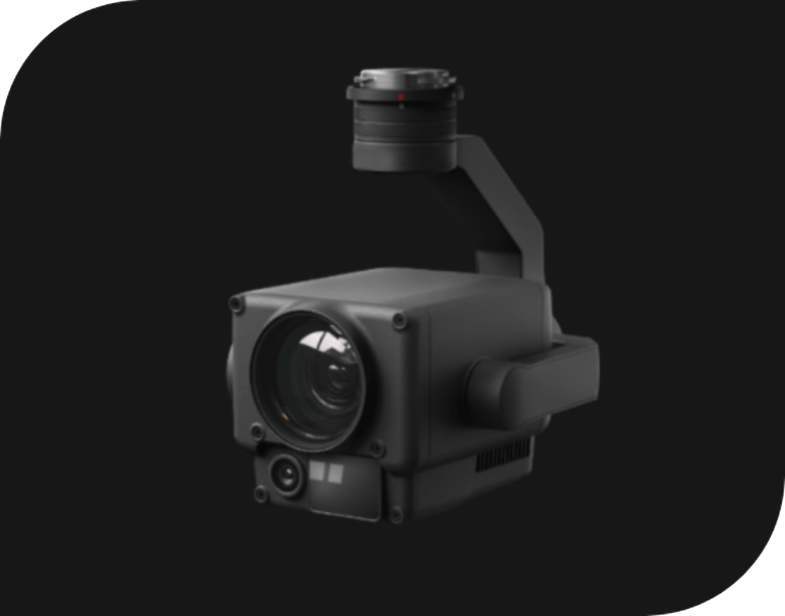
Drone Thermal Sensors
Our trained pilots fly drones equipped with thermal cameras at ideal vantage points, adding a new layer of valuable data to be captured: temperature.
- Radiometric Thermal Camera
- -20°C to 50°C Operating Temperatures
- IP44 Rating
TRANSMISSION & DISTRIBUTION
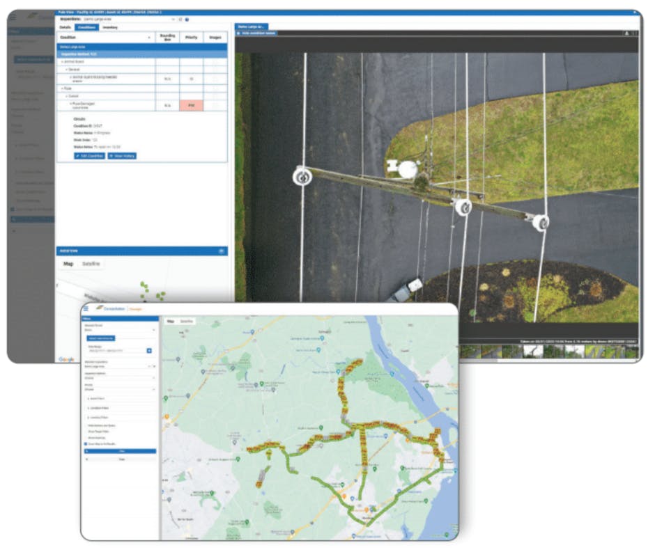
Secure Customer Portal Dashboard
The Clearsight customer portal provides easy and secure online access to actionable data from each inspection.
- Condition priorities ranked
- Recall past inspections quickly
- Digital datasets for each pole
Your Customizable Solution to Mitigate Wildfire Risks
Traditional Inspections & Wildfire Mitigation Solutions
- Manual driving or walking inspections
- Limited, ground-view vegetation inspections performed over months
- Exorbitant amount of data requiring manual data management and review processes
Clearsight Inspections & Wildfire Mitigation Solutions
- Advanced aerial, digital drone-powered inspections performed over days
- Certified thermographer drone pilots
- Optional inspection add-ons: Birds-eye-view vegetation inspections and management, including satellite inspections and LiDAR inspections with advanced tree health analysis, analytics, and insights
Our Methodology
We fuse cutting-edge drone technology, meticulous expert analysis, and centralized data management to drive proactive and precise maintenance decisions. Our comprehensive wildfire prevention services extend to vegetation management, wood pole health assessments, and LiDAR clearance distance surveys.
Wildfire Mitigation FAQ
-
How can utility companies mitigate wildfire risks?
Utility companies can mitigate wildfire risks by proactively conducting thorough, cyclical inspections of their infrastructure. This involves assessing overgrown vegetation and equipment health. Overheating, faulty or aged equipment, as well as unkept vegetation near transmission lines can increase the risks of starting a wildfire. -
What is a wildfire mitigation plan?
A wildfire mitigation plan is a strategy aimed at minimizing the risk, impact, and damage of wildfires. Wildfire mitigation plans consist of proactive measures like vegetation management, community preparedness, and infrastructure preparedness.
Reach Out to Our Wildfire Prevention Teams
Improve the safety and efficiency of your overhead line inspections with our UAV/drone technology, high-resolution drone imagery, and expert support. Contact our expert team to customize a wildfire prevention solution that empowers you to monitor your assets proactively, prioritize necessary actions, and thwart the threat of wildfires.
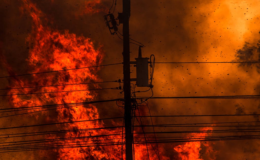
2023 Wildfire Season: The Critical Role of Transmission and Distribution Inspections